

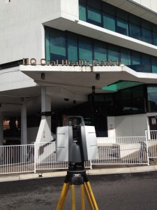
Jensen Bowers is committed to providing the highest level of technologically advanced geospatial solutions to the many markets we serve. We offer the latest in rapid and laser scanning surveys delivering highly detailed 3D data for use across multiple disciplines for engineering and architectural designs. The 360° field of view enables complete site coverage and substantial simultaneous data collection beyond the immediate area of interest, often eliminating the need for additional site visits.
Jensen Bowers provides comprehensive surveying services including:
- Engineering and architectural data collection
- Building Information Modeling (BIM)
- Detailed structural element location for residential, commercial and industrial buildings
- Stockpile volumes
- Rail, roads, bridges and tunnel detail
- Reverse engineering
Benefits
-
Significant time and cost savings
-
More accurate, more efficient, more control
-
Smart technology – real time data capture
-
CAD Connectivity
-
3D high definition point clouds
-
High resolution imagery
-
Rapid data capture – 1,000,000 points/second
- Comprehensive data sets
To find out more
Call Jensen Bowers to discuss your project requirements on 07 3319 4933 or by email.
RESOURCES
Laser Scanning Survey (PDF, 427KB)
NEW! Watch a demonstration of JB Laser Scanning Surveys: Fly Through Hi-def scan of Brisbane Showgrounds