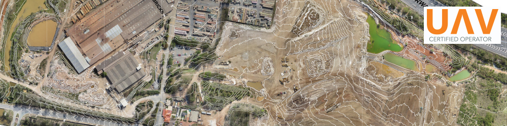
 Jensen Bowers is committed to providing the highest level of technologically advanced geospatial solutions to the many markets we serve. We offer Unmanned Aerial Vehicle (UAV) solutions that enable photography and traditional surveying to be completed on site in a single day. Together with photogrammetric software, we can generate 3D mapping of a site to a suitable accuracy, leading to invaluable, high quality, topographical data.
Jensen Bowers provides comprehensive surveying services including:
-
Digital Elevation Models (DEM)
-
Environmental and Agricultural Mapping
-
Volume Calculations
-
Infrastructure Inspections
-
Sales and Marketing Imagery
-
Photography / Video
-
Rectified Orthophotos.
Benefits
-
Smart technology – safe, fast and accurate
-
Cost-effective
-
Reduced personnel
- Survey of unsafe and inaccessible areas for direct access
-
Multi-purpose photography and video
-
JB is a participating member of the ‘Safety Leadership at Work Program‘.
Recent Project Experience
- Rochedale Motorway Estate
- Redbank Motorway Estate
- Shoreline Development
- Ashgrove Golf Course
To find out more
Call us to discuss your project requirements on 07 3319 4933 or via email.
RESOURCES
UAV Survey & Applications (PDF, 1.84 KB)
Our operations are CASA (Australia) Certified, flown to strict air safety guidelines by certified controllers under our CASA operator certificate.